Historic Map Overlays 1848-1956
Click on the images below to view historical maps of Minnesota,overlaid on Google Maps
|
Use this icon in the following links to change the transparency of the historic map.
|

|
WYOMING, Minnesota
1848
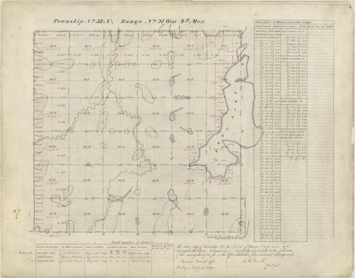
Earliest plat map of what is now Wyoming, MN. Notice the Comfort Lake is not pictured.
1888
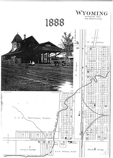
Plat of "downtown" Wyoming, in 1888.
ForEST Lake, Minnesota
1848
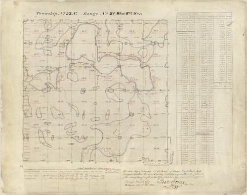
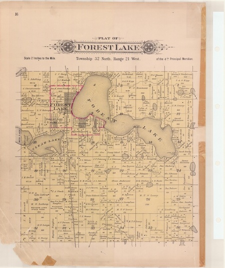
Before the first (non-Indian) settlers, Forest Lake was Township No. 32. In this overlay you see mostly water and wetland features, though these section lines make up many property boundaries today.
1869
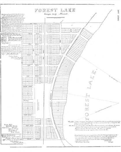
This map is different from the rest because it does not show the entire township, only the downtown area of Forest Lake.
A lot changed in 20 years. Minnesota became a state, and the railroad has come to Forest Lake.
A lot changed in 20 years. Minnesota became a state, and the railroad has come to Forest Lake.
1901
The twentieth century brings some big changes. Farms everywhere, roads, railroads, new businesses.
Created by the Northwest Publishing Co, Minneapolis, MN.
Created by the Northwest Publishing Co, Minneapolis, MN.
1912
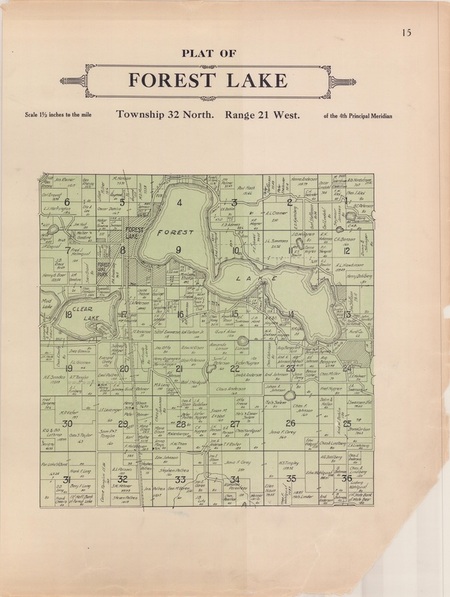
Ten years later, the downtown has built up to the point where the map can't hold the details. Also notice many more roads.
The detail that goes into the artwork around the title is amazing - they don't do that anymore.
Created by the Webb Publishing Co., St. Paul, MN
The detail that goes into the artwork around the title is amazing - they don't do that anymore.
Created by the Webb Publishing Co., St. Paul, MN
1926
Surprisingly, 1926 doesn't look much different from 1916.
Published by C.N. Swain, Minneapolis, MN
Published by C.N. Swain, Minneapolis, MN
1938
More roads!
The 1956 map shows locations for the four developments mapped at the bottom.
Published by the Hudson Map Company, Minneapolis, MN
The 1956 map shows locations for the four developments mapped at the bottom.
Published by the Hudson Map Company, Minneapolis, MN
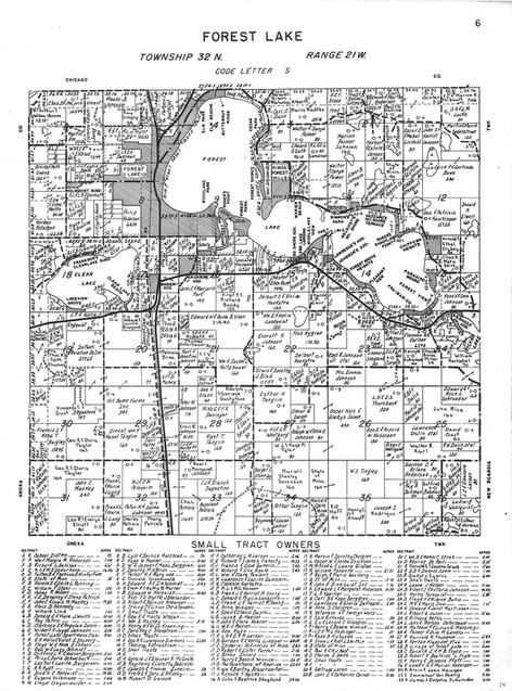
1949
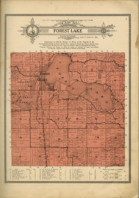
In 1949 we can see that US 61 and US 8 have gotten their titles, and that the city of Forest Lake has expanded considerably.
Published by The Atlas Company, St. Paul, MN
Published by The Atlas Company, St. Paul, MN
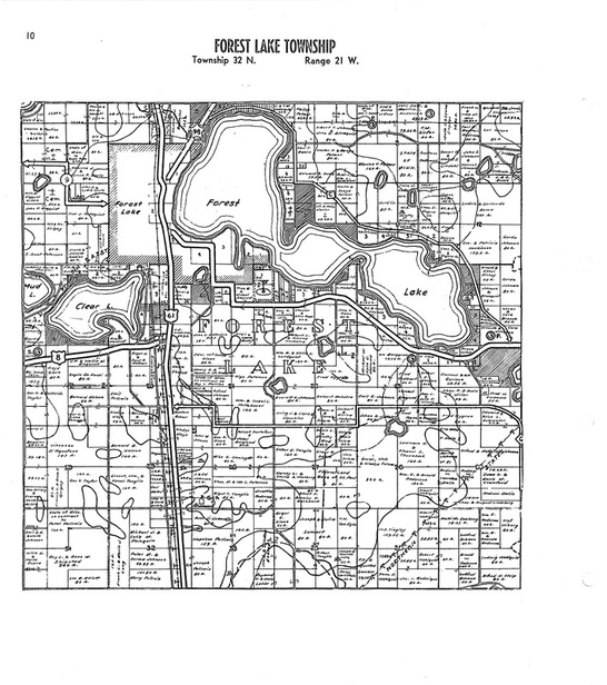
1956
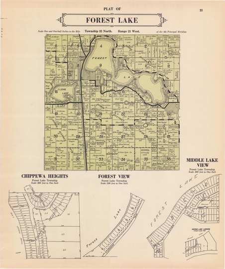
Properties have been subdivided to the point where property owners name's don't fit on the map itself and are listed at the bottom.
Published by the Thomas O. Nelson Company, Fergus Falls, MN
Published by the Thomas O. Nelson Company, Fergus Falls, MN
Maps courtesy of: Washington County Surveyor's Office and the Wyoming Historical Society
Map overlays created with MapTiler.
Map overlays created with MapTiler.
